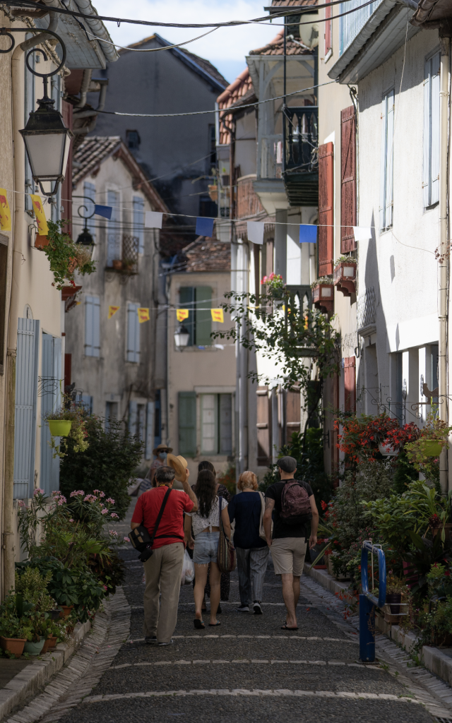
 Sauveterre-de-Béarn
+ HeritageSelf-guided tour of the city of Sauveterre-de-Béarn
0. Office de tourisme de Sauveterre-de-Béarn
Read the description
Welcome. I am Queen Sancie, Viscountess of Béarn. My husband Sanche has gone away to fight the Saracens. I’m expecting our future child, and as I count down the days, I’d like to show you around my land…
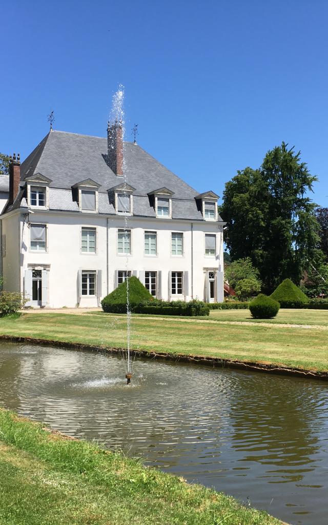
But first, let’s admire the magnificent view of the Pyrenees from the gardens opposite the town hall. Whatever the season, the landscape that unfolds before us never loses its charm. The white coat of winter over the snowy mountains gives way to hues of green and blue, as nature comes back to life in spring and summer…
Listen to the description
Sauveterre-0-Intro.mp3Sauveterre 0 - Intro
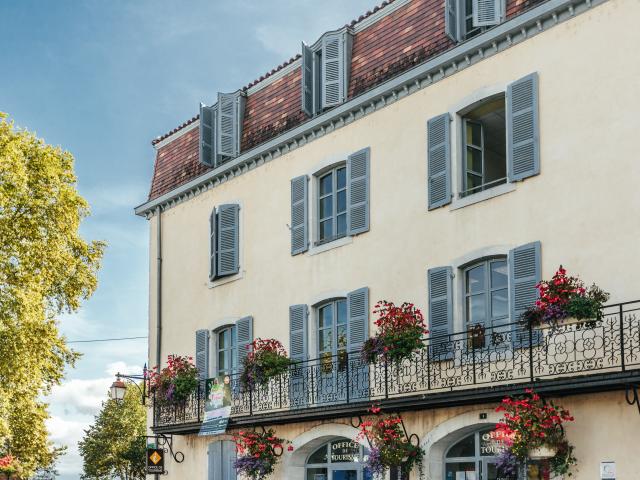 Office de tourisme à Sauveterre-de-Béarn
1. Hôtel de ville
Read the description
Opposite you is the town hall. In the 16th century, this beautiful Renaissance-style building belonged to the powerful Marquis de Nays family, the Counts of Sallette. Behind the building was the old orangery, deliciously fragrant when in flower. In 1972, the town bought the building and turned it into the present-day Town Hall. Opposite the town hall stands the church of Saint-André…
Listen to the description
Sauveterre-de-Bearn-1-Hotel-de-ville.mp3Sauveterre-de-Bearn 1 - Hotel de ville
2. Church of Saint-André
Read the description
Built in the 12th and 13th centuries, the church of Saint-André was part of the town’s defences. From the top of its bell tower, soldiers kept watch over anyone entering via the Gave. Romanesque on the outside and part Gothic on the inside, it boasts a beautiful tympanum above the main entrance.
On the north wall, the small doorway of the Cagots is a reminder of the existence of this community, rejected by the rest of the population. Rumours attributing their origins to lepers, Visigoths or disinherited outcasts forced these unfortunate people to live outside the town and stay away from the rest of the townsfolk. A font was reserved for them and they had to follow the religious service from the back of the church.
Before you leave this spot, don’t miss the magnificent view of the Gave d’Oloron and the Pyrenees from the orientation table. It’s so pleasant to bask in the sunshine as you lose yourself in the incredible views. The steps at the end of the church car park lead down to the banks of the Gave, where the Tour Monréal is not to be missed…
Listen to the description
Sauveterre-de-Bearn-2-Church-of-Saint-Andre.mp3Sauveterre-de-Bearn 2 - Church of Saint-Andre
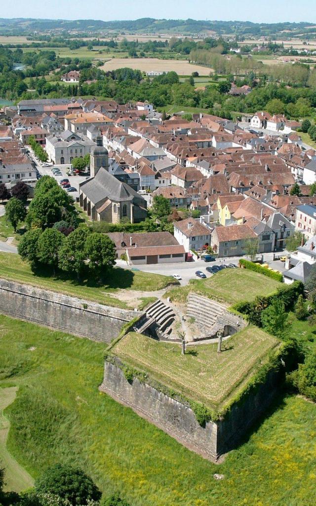
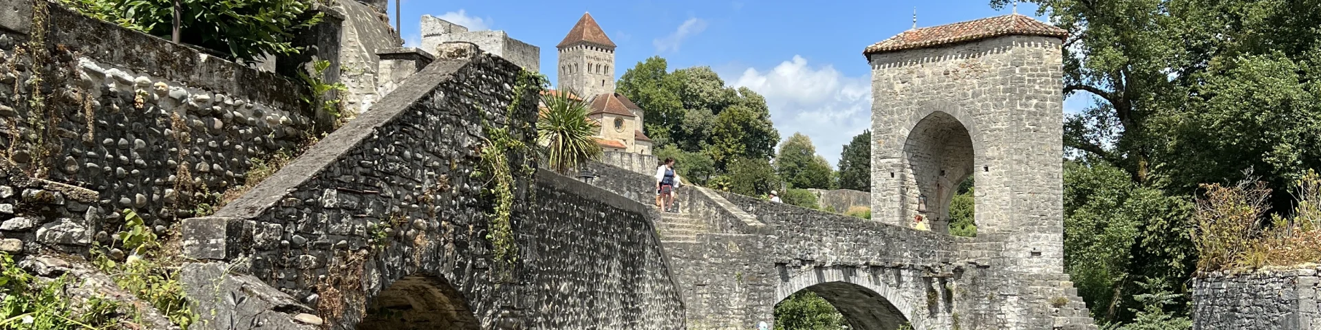
3. Tour Monréal
Read the description
A medieval keep, the Monréal Tower is 30 metres high and keeps watch over the Gave. Once fitted with defensive hoardings on which the soldiers could stand watch, it has few openings, giving it a massive deterrent aspect. Thanks to a system of curtain walls, it was linked to the castle and served as a refuge for the Viscount in the event of an attack. Today, it houses the model of the medieval town, a little jewel made of stone and mahogany that took more than 15,000 hours to build.
The tower owes its name to the family who bought it in the 19th century to save it from destruction.
Follow the shady path down by the waters of the Gave… Pass under the arches of the Pont de la Légende, until you reach the footbridge leading to the Île de la Glère, opposite the Camping du Gave.
Listen to the description
Sauveterre-de-Bearn-3-Tour-Monreal.mp3Sauveterre-de-Bearn 3 - Tour Monreal
4. Île de la Glère
Read the description
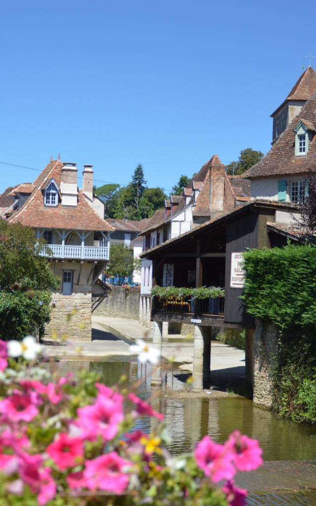
Listed as a Sensitive Natural Area, the Île de la Glère is Sauveterre’s 4th most important site, alongside the church of Saint-André, the Tour Monréal and the Pont de la Légende. Like the medieval town, the island has evolved over time. With two bridges linking it to each of the banks of the Gave, it was the gateway to the town. Of these two bridges, only the Pont de la Légende remains. All that remains of the Pont de la Réclusy (also known as the Pont de la Justice) are a few stones in the middle of the left bank. As the island was once marshy, a footbridge on stilts was built to cross it. Today, the island is a haven of peace where you can sit on the pebbles and daydream, lulled by the sound of the river and birdsong.
Let’s retrace our steps until we reach the Pont de la Légende, a majestic sight over the Gave…
Listen to the description
Sauveterre-de-Bearn-4-Ile-de-la-Glere.mp3Sauveterre-de-Bearn 4 - Ile de la Glere. Date de sortie : 2025.
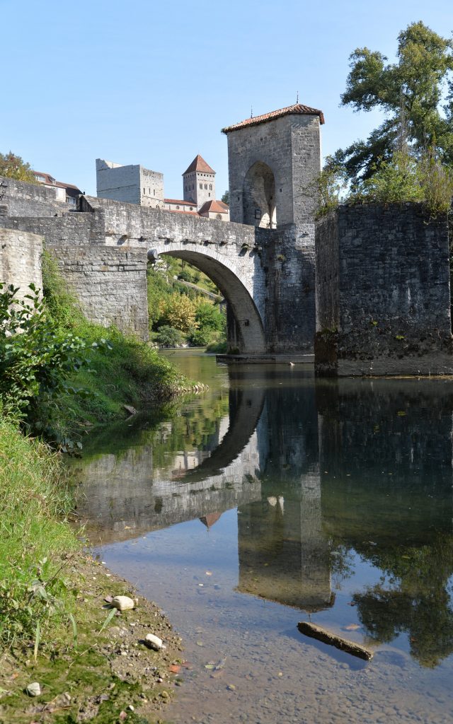
5. Pont de la Légende
Read the description
Once equipped with a wooden drawbridge linking it to the island, this bridge was used to enter and leave the medieval town. The narrow bridge was designed so that only two lines of pack animals could pass each other. Soldiers controlled the drawbridge from the lodge on the 1st floor. A toll was charged to enter the city. A table of tolls shows just how wealthy the town was between the 12th and 16th centuries. Agricultural produce, spices from the south, silk and textiles from the north and precious materials all passed across the bridge. Sauveterre was one of the main towns in Béarn, along with Orthez, Morlaàs and Oloron. Finally, this bridge is linked to a legend, my legend, that of Queen Sancie… Subjected to God’s judgement because I was accused of witchcraft after giving birth to a stillborn child while my husband was away fighting the Saracens, I was tied hand and foot, and thrown into the river Gave. But against all odds, three arrow-shots away, a white shape was seen to rise to the surface… It was me, Sancie, very much alive. My survival proved my innocence.
Behind us, at the entrance to the bridge, were the Chambers of the Pont de la Légende, once a hospital for pilgrims, now a bed and breakfast.
Listen to the description
Sauveterre-de-Bearn-5-Pont-de-la-Legende.mp3Sauveterre-de-Bearn 5 Pont de la Legende
6. Pilgrims’ hospital
Read the description
It was here that pilgrims could rest at the end of a long day’s walk, before crossing the bridge and carrying on towards Compostela. It was also here that all kinds of sick people were treated. Just below the hospital there used to be a small cemetery for those who could no longer continue their journey… Rumour has it that the location of this hospital was not chosen by chance. Placing this type of building, with its germs and contagions, close to a gateway into the town could would dissuade many from entering the city…
Let’s carry on up the lane to the fortified Lester gate.
Listen to the description
Sauveterre-de-Bearn-6-Pilgrims-hospital.mp3Sauveterre-de-Bearn 6 - Pilgrims hospital
7. Porte de Lester
Read the description
Before you go through the Lester Gate, you’ll see the position of an old gun port, on the wall on the right of the ramparts. It sets the tone: enter, and you are under heavy guard! Once you’ve passed through the gate, you’re back inside the medieval city walls. Traces of hinges on the sides of the gate show the size and power of this gateway to the town.
Continue up Rue Pléguignou until you reach the Maison Forte right at the top.
Listen to the description
Sauveterre-de-Bearn-7-Porte-de-Lester.mp3Sauveterre-de-Bearn 7 Porte de Lester. Date de sortie : 2025.
8. Maison Forte
Read the description
Well placed at the very top of the lane, the Maison Forte or Strong House offered soldiers a highly strategic location. Fitted with defensive hoardings where sentries could be posted, it overlooked the Lester Gate at the bottom of the lane, as well as the Datter Gate on your left. Here, we are in the very heart of the town, where sheep markets, poultry markets and tanneries made for a lively atmosphere.
Now, turn your back to the fortified house and your view is drawn to an imposing building with exposed stones on the right: the Arsenal.
Listen to the description
Sauveterre-de-Bearn-8-Maison-Forte.mp3Sauveterre-de-Bearn 8 - Maison Forte
9. Arsenal
Read the description
Today in private ownership, this splendid building was used for storing weapons and powder in times of war. Do go through the Datter Gate for a better view of the Arsenal and the remains of the town’s west ramparts.
Listen to the description
Sauveterre-de-Bearn-9-Arsenal.mp3Sauveterre-de-Bearn 9 - Arsenal
10. Porte du Datter
Read the description
With a covered walkway and a wooden drawbridge for getting across the moat, the Datter Gate opened and closed the city while keeping a lookout for approaches from the west. Let’s venture outside the city and have a look at the remains of the imposing ramparts to your left.
Listen to the description
Sauveterre-de-Bearn-10-Porte-du-Datter.mp3Sauveterre-de-Bearn 10 - Porte du Datter
11. The Ramparts
Read the description
Thanks to the long, narrow openings, known as double-splayed arrowslits, the soldiers were able to both observe and fire from here. Like the walls of the Tour Monréal and the Maison Forte, the ramparts that surrounded the medieval city were equipped with defensive hoardings on which the soldiers stood to keep watch over all approaches to the town. Below the ramparts, colourful gardens planted with flowers and fruit trees add a touch of romance to what were once simply ditches.
Let’s head back via the Datter Gate or the Rue Léon Bérard to reach the Barbican, once the gateway to the Viscount’s chateau.
Listen to the description
Sauveterre-de-Bearn-11-The-Rampartsmp3.mp3Sauveterre-de-Bearn 11 - The Ramparts
12. The Chateau
Read the description
Separated from the chateau walls, the Barbican, an artificial stone mound, formed the entrance to the chateau. A wooden footbridge spanning the dry moat connected the two. Thanks to its narrow size, the Barbican offered protection from being attacked by battering ram.
Built in the 13th century under Gaston VII Moncade, the castle became the hunting residence of Gaston Fébus, Count of Foix and Béarn, who adapted it in the 14th century. Though it was largely destroyed in the 16th century, when a large part of its southern facade fell into the Gave, it still hosted many a banquet. Imagine those festive, joyous times, when hunters, ladies of the court and their attendants would return from the hunt… It was here that the powerful Fébus, a great hunter but also a poet in his spare time, is said to have written the famous anthem ‘Aqueras Montanhas’ while looking out on our Pyrenees. Legend also has it that it was on his way back from a bear hunt at l’Hôpital-d’Orion, not far from Sauveterre, that Gaston Fébus fell sick and was carried back to the castle, where he breathed his last breath.
Let’s finish our stroll by walking up the Rue des Innocents, with a charming little tower in front of us, from which our feathered friends watch over the town.
Listen to the description
Sauveterre-de-Bearn-12-The-Chateau.mp3Sauveterre-de-Bearn 12 - The Chateau
13. Pigeonnier
Read the description
Part of the town’s northern ramparts, this small tower served as a dovecote or, more accurately, as a relay for carrier pigeons. Several specimens can still be seen today. You never know, they could be descended from the Viscounts’ pigeons! It isn’t so very hard to imagine…
Sauveterre now holds no secrets for you, and I’m glad to have shared my much-loved city with you… I hope I’ve helped you dream and travel back to see what life was like in this medieval city in these lands of mine. Take your time strolling through the narrow streets, and be sure to come back and see us soon!
Listen to the description
Sauveterre-de-Bearn-13-Pigeonnier.mp3Sauveterre-de-Bearn 13 - Pigeonnier